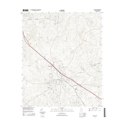
2014 Map of Forsyth
USGS Topo · Published 2014About this map
Forsyth serves as the focal point of this Central Georgia landscape, where the confluence of regional roads and historic settlement patterns is clearly visible. The town's growth is anchored by major hubs like Brighton Mills and Star Mills, while smaller surrounding communities such as Box Ankle, Logwall, and Maynard maintain their distinct identities along the rural periphery. This 2014 survey documents a high density of burial grounds, including the Forsyth City Cem and the Monroe Hills Memorial Gardens, providing significant data for genealogical research in Monroe County. The natural drainage of the area is defined by the Towaliga River in the north and a network of creeks like Rum Cr and Rocky Cr. Numerous water bodies, including Pace Lake, Hook Pond, and Millwood Lake, are scattered throughout the terrain, illustrating how water resources shaped early milling operations and subsequent land use.
Find a feature on this map
136 named features on this map. Tap any name to fly to it.
Don’t see what you’re looking for? This feature index may not catch every label — zoom into the map to look around manually.
Map Details
Editions of this 2014 Forsyth Map
This is the sole edition of this map. No revisions or reprints were ever made.
Other maps of this area

1951 · Yatesville
USGS Topo · 1:62,500

1951 · Forsyth
USGS Topo · 1:62,500

1951 · Barnesville
USGS Topo · 1:62,500

1953 · Atlanta
USGS Topo · 1:250,000

1953 · Athens
USGS Topo · 1:250,000

1955 · Phenix City
USGS Topo · 1:250,000

1956 · Bolingbroke
USGS Topo · 1:62,500

1957 · Phenix City
USGS Topo · 1:250,000

1957 · Macon
USGS Topo · 1:250,000

1957 · Atlanta
USGS Topo · 1:250,000