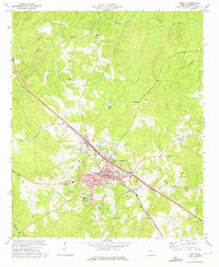
1973 Map of Forsyth
USGS Topo · Published 1976About this map
The city of Forsyth serves as the focal point of this 1970s survey, showing its development at the intersection of local industry and education. Higher education and local instruction are prominent through the campus of Tift College, Hubbard High Sch, and Monroe Academy. The Central Of Georgia railroad cuts diagonally through the landscape, a primary artery for the region's economy that passes near the Courthouse and City Hall.
Find a feature on this map
44 named features on this map. Tap any name to fly to it.
Don’t see what you’re looking for? This feature index may not catch every label — zoom into the map to look around manually.
Map Details
Editions of this 1973 Forsyth Map
2 editions found
Other maps of this area

1951 · Yatesville
USGS Topo · 1:62,500

1951 · Forsyth
USGS Topo · 1:62,500

1951 · Barnesville
USGS Topo · 1:62,500

1953 · Atlanta
USGS Topo · 1:250,000

1953 · Athens
USGS Topo · 1:250,000

1955 · Phenix City
USGS Topo · 1:250,000

1956 · Bolingbroke
USGS Topo · 1:62,500

1957 · Phenix City
USGS Topo · 1:250,000

1957 · Macon
USGS Topo · 1:250,000

1957 · Atlanta
USGS Topo · 1:250,000