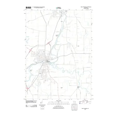
2010 Map of Fort Atkinson
USGS Topo · Published 2010About this map
The Rock River and Bark River converge at Fort Atkinson, defining the geography of this Jefferson County community as it appeared in the early 21st century. The map shows the city's residential and industrial footprint, centered around the Fort Atkinson Post Office and extending south toward Haumerson Pond. Local heritage is well-documented through the presence of several large burial grounds, including Rock River Cemetery, Evergreen Cemetery, and Lakeview Cemetery.
Find a feature on this map
53 named features on this map. Tap any name to fly to it.
Don’t see what you’re looking for? This feature index may not catch every label — zoom into the map to look around manually.
Map Details
Editions of this 2010 Fort Atkinson Map
This is the sole edition of this map. No revisions or reprints were ever made.
Other maps of this area

1891 · Waterloo
USGS Topo · 1:62,500

1891 · Koshkonong
USGS Topo · 1:62,500

1892 · Watertown
USGS Topo · 1:62,500

1892 · Whitewater
USGS Topo · 1:62,500

1893 · Whitewater
USGS Topo · 1:62,500

1894 · Waterloo
USGS Topo · 1:62,500

1894 · Watertown
USGS Topo · 1:62,500

1894 · Koshkonong
USGS Topo · 1:62,500

1903 · Whitewater
USGS Topo · 1:62,500

1906 · Koshkonong
USGS Topo · 1:62,500