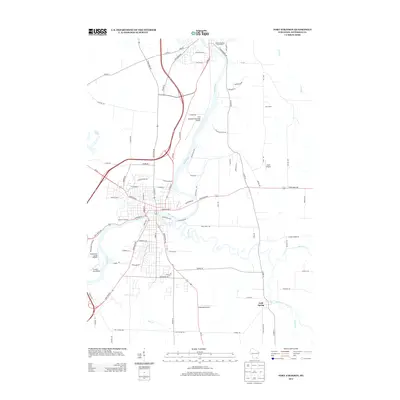
2013 Map of Fort Atkinson
USGS Topo · Published 2013About this map
The Rock River and Bark River converge in this Jefferson County landscape, anchoring a region defined by its water systems and early 21st-century aviation network. Notable for its archaeological significance, the map highlights the Panther Intaglio, a rare effigy mound located near the bend of the river. The settlement of Cold Spring sits at the junction of Whitewater Creek and Galloway Cr, illustrating the long-standing importance of these riparian corridors for local habitation and transport.
Find a feature on this map
93 named features on this map. Tap any name to fly to it.
Don’t see what you’re looking for? This feature index may not catch every label — zoom into the map to look around manually.
Map Details
Editions of this 2013 Fort Atkinson Map
This is the sole edition of this map. No revisions or reprints were ever made.
Other maps of this area

1891 · Waterloo
USGS Topo · 1:62,500

1891 · Koshkonong
USGS Topo · 1:62,500

1892 · Watertown
USGS Topo · 1:62,500

1892 · Whitewater
USGS Topo · 1:62,500

1893 · Whitewater
USGS Topo · 1:62,500

1894 · Waterloo
USGS Topo · 1:62,500

1894 · Watertown
USGS Topo · 1:62,500

1894 · Koshkonong
USGS Topo · 1:62,500

1903 · Whitewater
USGS Topo · 1:62,500

1906 · Koshkonong
USGS Topo · 1:62,500