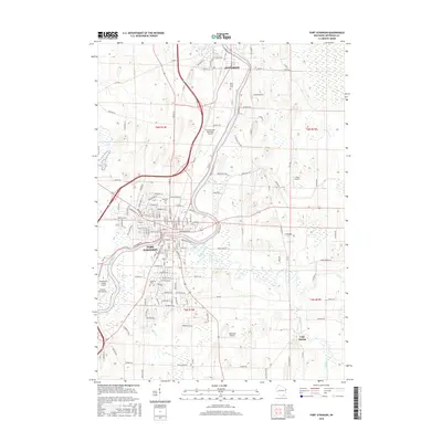
2016 Map of Fort Atkinson
USGS Topo · Published 2016About this map
Rock River and Bark River converge in the heart of Fort Atkinson, defining the city’s layout and historical development along the water. This 21st-century survey illustrates the expansion of the urban core around landmarks like Haumerson Pond and local burial grounds such as Evergreen Cem and Lakeview Cem. To the north, the city of Jefferson sits along the same river corridor, separated by a stretch of agricultural land and the Fort Atkinson Municipal Airport. The landscape is characterized by its drainage patterns, with Allen Creek, Whitewater Creek, and Galloway Creek flowing toward the main river systems. To the southeast, the small settlement of Cold Spring remains a distinct point of interest. Several private airstrips, including Oakbrook Airport and J Rock Airport, dot the surrounding rural sections, reflecting the modern utility and infrastructure of this Jefferson County region.
Find a feature on this map
145 named features on this map. Tap any name to fly to it.
Don’t see what you’re looking for? This feature index may not catch every label — zoom into the map to look around manually.
Map Details
Editions of this 2016 Fort Atkinson Map
This is the sole edition of this map. No revisions or reprints were ever made.
Other maps of this area

1891 · Waterloo
USGS Topo · 1:62,500

1891 · Koshkonong
USGS Topo · 1:62,500

1892 · Watertown
USGS Topo · 1:62,500

1892 · Whitewater
USGS Topo · 1:62,500

1893 · Whitewater
USGS Topo · 1:62,500

1894 · Waterloo
USGS Topo · 1:62,500

1894 · Watertown
USGS Topo · 1:62,500

1894 · Koshkonong
USGS Topo · 1:62,500

1903 · Whitewater
USGS Topo · 1:62,500

1906 · Koshkonong
USGS Topo · 1:62,500