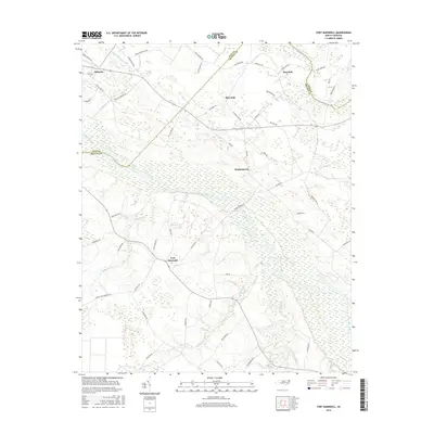
2016 Map of Fort Barnwell
USGS Topo · Published 2016About this map
Fort Barnwell sits at the heart of this landscape, positioned along the southern banks of the Neuse River where it meets Village Cr. The area is characterized by a sophisticated network of early drainage infrastructure including the Buckleberry Canal, Saint Johns Canal, and Shiloh Canal, which historically supported the agricultural transformation of these low-lying coastal plains. This 2016 survey documents the enduring layout of rural crossroads settlements like Maplecypress and Riverside, and the more distant Honolulu near the Pitt Co and Craven Co line.
Find a feature on this map
63 named features on this map. Tap any name to fly to it.
Don’t see what you’re looking for? This feature index may not catch every label — zoom into the map to look around manually.
Map Details
Editions of this 2016 Fort Barnwell Map
This is the sole edition of this map. No revisions or reprints were ever made.
Other maps of this area

1901 · New Bern
USGS Topo · 1:62,500

1902 · Ayden
USGS Topo · 1:62,500

1902 · Vanceboro
USGS Topo · 1:62,500

1903 · New Bern
USGS Topo · 1:62,500

1903 · Trent River
USGS Topo · 1:62,500

1904 · Ayden
USGS Topo · 1:62,500

1904 · Trent River
USGS Topo · 1:62,500

1904 · Vanceboro
USGS Topo · 1:62,500

1905 · Vanceboro
USGS Topo · 1:62,500

1953 · Rocky Mount
USGS Topo · 1:250,000