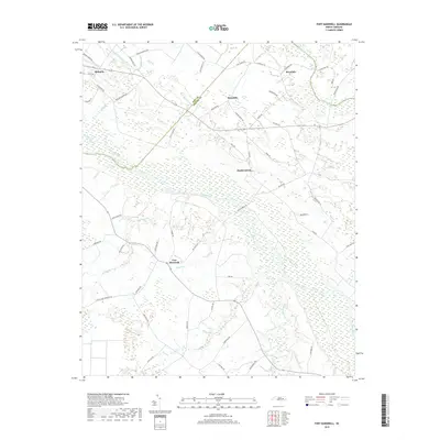
2019 Map of Fort Barnwell
USGS Topo · Published 2019About this map
The Neuse River winds through this coastal plain landscape, serving as the central geographic feature for the small settlements and agricultural tracts near the Pitt Co and Craven Co line. The historic location of Fort Barnwell stands south of the river, surrounded by a complex network of wetlands and tributaries like Village Cr and Gum Swamp. This area is defined by its water management history, evidenced by a series of engineered waterways including the Markel Canal, Shiloh Canal, and Buckleberry Canal that drainage the low-lying terrain north of the river.
Find a feature on this map
66 named features on this map. Tap any name to fly to it.
Don’t see what you’re looking for? This feature index may not catch every label — zoom into the map to look around manually.
Map Details
Editions of this 2019 Fort Barnwell Map
This is the sole edition of this map. No revisions or reprints were ever made.
Other maps of this area

1901 · New Bern
USGS Topo · 1:62,500

1902 · Ayden
USGS Topo · 1:62,500

1902 · Vanceboro
USGS Topo · 1:62,500

1903 · New Bern
USGS Topo · 1:62,500

1903 · Trent River
USGS Topo · 1:62,500

1904 · Ayden
USGS Topo · 1:62,500

1904 · Trent River
USGS Topo · 1:62,500

1904 · Vanceboro
USGS Topo · 1:62,500

1905 · Vanceboro
USGS Topo · 1:62,500

1953 · Rocky Mount
USGS Topo · 1:250,000