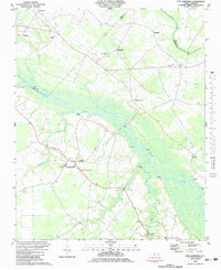
1983 Map of Fort Barnwell
USGS Topo · Published 1983About this map
The Neuse River meanders through the heart of this coastal plain landscape, dividing the borderlands of Pitt and Craven Counties. Along its winding banks, several historic river access points like Biddle Landing, Village Landing, and Pitchkettle Landing indicate the long-standing importance of the waterway to local commerce and travel. The settlement of Fort Barnwell serves as a primary local landmark, situated amidst a network of rural roads that connect small community hubs such as Maplecypress and Riverside.
Find a feature on this map
36 named features on this map. Tap any name to fly to it.
Don’t see what you’re looking for? This feature index may not catch every label — zoom into the map to look around manually.
Map Details
Editions of this 1983 Fort Barnwell Map
This is the sole edition of this map. No revisions or reprints were ever made.
Other maps of this area

1901 · New Bern
USGS Topo · 1:62,500

1902 · Ayden
USGS Topo · 1:62,500

1902 · Vanceboro
USGS Topo · 1:62,500

1903 · New Bern
USGS Topo · 1:62,500

1903 · Trent River
USGS Topo · 1:62,500

1904 · Ayden
USGS Topo · 1:62,500

1904 · Trent River
USGS Topo · 1:62,500

1904 · Vanceboro
USGS Topo · 1:62,500

1905 · Vanceboro
USGS Topo · 1:62,500

1953 · Rocky Mount
USGS Topo · 1:250,000