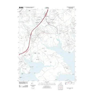
2011 Map of Fort Belvoir
USGS Topo · Published 2011About this map
Pohick Creek and Accotink Creek drain into the broad tidal inlets of Pohick Bay and Accotink Bay, defining a landscape where suburban expansion meets the historic Potomac riverfront. The map captures the complex infrastructure of southern Fairfax County, showing the proximity of the Lorton Reformatory to established residential communities like Springfield Oaks and Rollingwood. Traditional landmarks such as the Pohick Churchyard and the Accotink United Methodist Church Cemetery stand as anchors of local history amidst a dense network of modern transit corridors, including Backlick Rd and Telegraph Rd. Along the shoreline, recreational and conservation spaces like the Wilson Scout Reservation and the Pohick Bay Regional Park Golf Course occupy the peninsulas of Pohick Neck and Mason Neck, preserving significant open space where Kanes Creek meets Belmont Bay.
Find a feature on this map
106 named features on this map. Tap any name to fly to it.
Don’t see what you’re looking for? This feature index may not catch every label — zoom into the map to look around manually.
Map Details
Editions of this 2011 Fort Belvoir Map
This is the sole edition of this map. No revisions or reprints were ever made.
Other maps of this area

1890 · Mt. Vernon
USGS Topo · 1:125,000

1891 · Mt. Vernon
USGS Topo · 1:125,000

1894 · Mt. Vernon
USGS Topo · 1:125,000

1897 · Mt. Vernon
USGS Topo · 1:125,000

1900 · Washington
USGS Topo · 1:62,500

1913 · Indian Head
USGS Topo · 1:62,500

1915 · Fairfax
USGS Topo · 1:62,500

1923 · Indian Head
USGS Topo · 1:48,000

1925 · Indian Head
USGS Topo · 1:62,500

1927 · Quantico
USGS Topo · 1:62,500