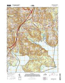
2016 Map of Fort Belvoir
USGS Topo · Published 2016About this map
Pohick Neck and Belvoir Neck dominate this landscape where the Potomac River meets a complex network of coastal inlets. This modern survey illustrates the suburban expansion of Fairfax Co in the mid-2010s, yet it meticulously preserves the locations of early colonial and family history. Numerous small burial grounds, such as the Millan-Potter Family Cem, Triplett Family Cem, and Chichester Family Cem, are marked alongside historic congregations at Pohick Episcopal Church and Silverbrook United Methodist Church.
Find a feature on this map
85 named features on this map. Tap any name to fly to it.
Don’t see what you’re looking for? This feature index may not catch every label — zoom into the map to look around manually.
Map Details
Editions of this 2016 Fort Belvoir Map
This is the sole edition of this map. No revisions or reprints were ever made.
Other maps of this area

1890 · Mt. Vernon
USGS Topo · 1:125,000

1891 · Mt. Vernon
USGS Topo · 1:125,000

1894 · Mt. Vernon
USGS Topo · 1:125,000

1897 · Mt. Vernon
USGS Topo · 1:125,000

1900 · Washington
USGS Topo · 1:62,500

1913 · Indian Head
USGS Topo · 1:62,500

1915 · Fairfax
USGS Topo · 1:62,500

1923 · Indian Head
USGS Topo · 1:48,000

1925 · Indian Head
USGS Topo · 1:62,500

1927 · Quantico
USGS Topo · 1:62,500