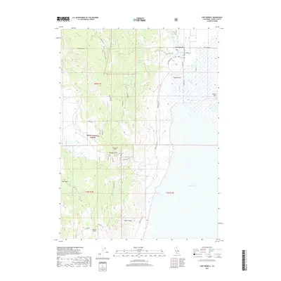
2018 Map of Fort Bidwell
USGS Topo · Published 2018About this map
Fort Bidwell sits at the edge of the high desert and the Warner Mountains, serving as a gateway to the arid expanse of Surprise Valley. This modern survey illustrates the intersection of a remote northern California settlement and the vast protected lands of the Modoc National Forest. To the west, the terrain rises sharply toward Fandango Peak and Fandango Pass, historical markers of western migration. The map detail highlights the hydrological features essential to this dry environment, from the Upper Lake basin to smaller points like Fossett Spring and a Hot Spring near the town center. Local canyons such as Shartell Canyon and Vaughn Canyon cut through the landscape, while numerous secondary routes like Fandango Pass Rd and Bear Valley road trace the paths between the mountains and the valley floor.
Find a feature on this map
41 named features on this map. Tap any name to fly to it.
Don’t see what you’re looking for? This feature index may not catch every label — zoom into the map to look around manually.
Map Details
Editions of this 2018 Fort Bidwell Map
This is the sole edition of this map. No revisions or reprints were ever made.
Other maps of this area

1886 · Alturas
USGS Topo · 1:250,000

1892 · Alturas
USGS Topo · 1:250,000

1954 · Alturas
USGS Topo · 1:250,000

1958 · Alturas
USGS Topo · 1:250,000

1962 · Alturas
USGS Topo · 1:250,000

1962 · Davis Creek
USGS Topo · 1:62,500

1962 · Willow Ranch
USGS Topo · 1:62,500

1962 · Cedarville
USGS Topo · 1:62,500

1962 · Fort Bidwell
USGS Topo · 1:62,500

1965 · Alturas
USGS Topo · 1:250,000