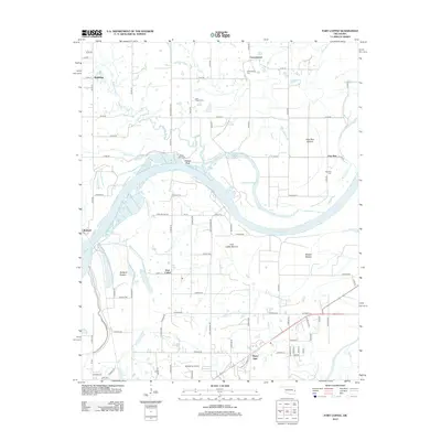
2012 Map of Fort Coffee
USGS Topo · Published 2012About this map
The Arkansas River carves a sweeping path through this LeFlore County landscape, defining the fertile lowlands of the Fort Coffee Bottom and Redland Bottom. The settlement of Fort Coffee sits at a strategic bend near the river, south of the Cherokee Chute. This area is characterized by a dense network of country roads and several established burial grounds, including Cottonwood Cem, Lees Chapel Cem, and the Wilson Rock Cem near the riverbank.
Find a feature on this map
80 named features on this map. Tap any name to fly to it.
Don’t see what you’re looking for? This feature index may not catch every label — zoom into the map to look around manually.
Map Details
Editions of this 2012 Fort Coffee Map
This is the sole edition of this map. No revisions or reprints were ever made.
Other maps of this area

1879 · Fort Smith
USGS Topo · 1:62,500

1887 · Van Buren
USGS Topo · 1:62,500

1887 · Greenwood
USGS Topo · 1:62,500

1890 · Fort Smith
USGS Topo · 1:125,000

1900 · Sallisaw
USGS Topo · 1:125,000

1911 · Sallisaw
USGS Topo · 1:125,000

1943 · Fort Smith
USGS Topo · 1:125,000

1946 · Fort Smith
USGS Topo · 1:250,000

1947 · Van Buren
USGS Topo · 1:62,500

1947 · Greenwood
USGS Topo · 1:62,500