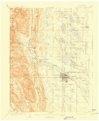
1908 Map of Fort Collins
USGS Topo · Published 1923About this map
Fort Collins serves as the industrial and academic hub in this early 20th-century landscape, dominated by the campus of the Colorado State Agricultural College and an intricate network of irrigation engineering. The Cache La Poudre River winds from the mountains of the Colorado National Forest into a valley transformed by human design, where massive efforts like the Larimer and Weld Canal and the Larimer and Weld Reservoir dictate the agricultural potential of the plains. To the west, the foothills rise sharply, featuring landmarks such as Horsetooth and the Empire Mine. Small settlements like Wellington, Laporte, and Bellvue are connected by branches of the Southern RR, illustrating a period when rail transport and water rights were the primary drivers of growth in Larimer County.
Find a feature on this map
83 named features on this map. Tap any name to fly to it.
Don’t see what you’re looking for? This feature index may not catch every label — zoom into the map to look around manually.
Map Details
Editions of this 1908 Fort Collins Map
4 editions found
Other maps of this area

1902 · Greeley
USGS Topo · 1:125,000

1905 · Mount Olympus
USGS Topo · 1:62,500

1906 · Loveland
USGS Topo · 1:62,500

1906 · Fort Collins
USGS Topo · 1:62,500

1907 · Mount Olympus
USGS Topo · 1:62,500

1907 · Livermore
USGS Topo · 1:125,000

1908 · Loveland
USGS Topo · 1:62,500

1908 · Fort Collins
USGS Topo · 1:62,500

1908 · Eaton
USGS Topo · 1:125,000

1909 · Livermore
USGS Topo · 1:125,000