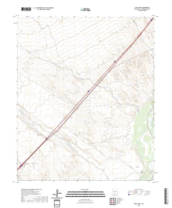
2023 Map of Fort Craig
USGS Topo · Published 2023About this map
Fort Craig stands as the primary landmark of this high-desert landscape in Socorro County, positioned west of the Rio Grande. The settlement and nearby Fort Craig Cem represent a significant military and historical footprint in a region defined by its drainage systems and canyons. Modern access is facilitated by Ft Craig Rd and Willow Springs Ranch Rd, which cross a terrain carved by Quates Canyon and Milligan Gulch. The map illustrates the hydrological patterns of the arid basin, featuring ephemeral watercourses like Rocky Arroyo, Spikey Arroyo, and Rock Creek. The surveyor's data captures the intersection of early settlement sites with contemporary infrastructure, providing a clear view of the area's geography and the legacy of the fort.
Find a feature on this map
15 named features on this map. Tap any name to fly to it.
Don’t see what you’re looking for? This feature index may not catch every label — zoom into the map to look around manually.
Map Details
Editions of this 2023 Fort Craig Map
This is the sole edition of this map. No revisions or reprints were ever made.
Other maps of this area

1948 · San Antonio
USGS Topo · 1:62,500

1948 · Val Verde
USGS Topo · 1:62,500

1954 · Tularosa
USGS Topo · 1:250,000

1958 · Tularosa
USGS Topo · 1:250,000

1961 · Hickman Ranch
USGS Topo · 1:24,000

1961 · Paraje Well
USGS Topo · 1:24,000

1961 · Black Hill
USGS Topo · 1:24,000

1961 · Fort Craig
USGS Topo · 1:24,000
1965 · Puertecito Gap
USGS Topo · 1:24,000
1965 · Cienega Ranch
USGS Topo · 1:24,000