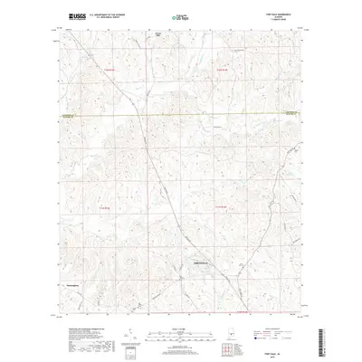
2018 Map of Fort Dale
USGS Topo · Published 2018About this map
Greenville serves as the focal point for this region of Butler County, where the landscape is defined by the headwaters of numerous creeks and several recreational reservoirs. Local history and genealogy interests are centered on a series of significant burial grounds, including the centrally located Fort Dale Cem and the Shiloh Cem complex in the south. The terrain transitions from the heights of Clover Hill in the north toward the water-rich areas surrounding Sherling Lake and Upper Lake. The map reveals a transition from the structured street grid of northern Greenville into the outlying rural community of Manningham. Transportation corridors like Braggs Rd and Fort Dale Rd follow the natural ridges, connecting these small settlements across a network of drainage basins like Mussel Cr and Cedar Cr.
Find a feature on this map
42 named features on this map. Tap any name to fly to it.
Don’t see what you’re looking for? This feature index may not catch every label — zoom into the map to look around manually.
Map Details
Editions of this 2018 Fort Dale Map
This is the sole edition of this map. No revisions or reprints were ever made.
Other maps of this area

1953 · Montgomery
USGS Topo · 1:250,000

1953 · Andalusia
USGS Topo · 1:250,000

1956 · Montgomery
USGS Topo · 1:250,000

1957 · Montgomery
USGS Topo · 1:250,000

1957 · Andalusia
USGS Topo · 1:250,000

1957 · Braggs
USGS Topo · 1:62,500

1971 · Greenville West
USGS Topo · 1:24,000

1971 · Fort Deposit
USGS Topo · 1:24,000

1971 · Fort Dale
USGS Topo · 1:24,000

1971 · Greenville East
USGS Topo · 1:24,000