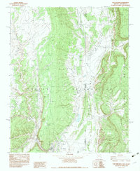
1982 Map of Fort Defiance
USGS Topo · Published 1983About this map
Fort Defiance serves as the focal point of this early 1980s provisional survey, situated within the vast expanse of the Navajo Indian Reservation along the border of Arizona and New Mexico. The landscape is defined by the dramatic ascent into the Chuska Mountains and the winding paths of Black Creek and its many tributaries, including White Clay Creek and Twin Buttes Wash. This era shows a community in transition, balancing modern infrastructure like a Radio Tower and Borrow Pit with the traditional geography of the high desert. Settlement patterns are concentrated near the town, while the surrounding Valley is marked by scattered utilitarian features such as a Corral, Stock Tank, and a lonely Grave. The intricate drainage network of Bonito Creek and Blue Creek illustrates the vital role of water management in this arid high-altitude environment.
Find a feature on this map
28 named features on this map. Tap any name to fly to it.
Don’t see what you’re looking for? This feature index may not catch every label — zoom into the map to look around manually.
Map Details
Editions of this 1982 Fort Defiance Map
2 editions found
Other maps of this area

1886 · Wingate
USGS Topo · 1:250,000

1886 · Fort Defiance
USGS Topo · 1:250,000

1892 · Fort Defiance
USGS Topo · 1:250,000

1892 · Wingate
USGS Topo · 1:250,000

1954 · Gallup
USGS Topo · 1:250,000

1955 · Zith-Tusayan Butte 4 NW
USGS Topo · 1:24,000

1955 · Zith-Tusayan Butte 4 NE
USGS Topo · 1:24,000

1955 · Zith-Tusayan Butte 1 SE
USGS Topo · 1:24,000
1955 · Zith-Tusayan Butte 1 NE
USGS Topo · 1:24,000
1955 · Zith-Tusayan Butte 1 NW
USGS Topo · 1:24,000