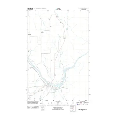
2011 Map of Fort Fairfield
USGS Topo · Published 2011About this map
The Aroostook River defines the heart of this Maine borderland, winding past the town of Fort Fairfield as it flows toward the Canadian border. This 2011 survey reveals a landscape deeply connected to its agricultural roots, with numerous rural settlements such as Goodrich, Stevensville, and Houghtonville scattered along a network of country roads. Higher elevations like Irish Ridge and Stewart Hill overlook the river valley, while smaller waterways like Hacker Brook and Libby Brook drain the surrounding fields.
Find a feature on this map
52 named features on this map. Tap any name to fly to it.
Don’t see what you’re looking for? This feature index may not catch every label — zoom into the map to look around manually.
Map Details
Editions of this 2011 Fort Fairfield Map
This is the sole edition of this map. No revisions or reprints were ever made.
Other maps of this area

1930 · Fort Fairfield
USGS Topo · 1:48,000

1933 · Fort Fairfield
USGS Topo · 1:62,500

1936 · Mars Hill
USGS Topo · 1:48,000

1940 · Mars Hill
USGS Topo · 1:62,500

1951 · Mars Hill
USGS Topo · 1:62,500

1951 · Fort Fairfield
USGS Topo · 1:62,500

1953 · Fort Fairfield NW
USGS Topo · 1:24,000
1953 · Limestone
USGS Topo · 1:24,000

1959 · Woodstock
USGS Topo · 1:250,000

1963 · Woodstock
USGS Topo · 1:250,000