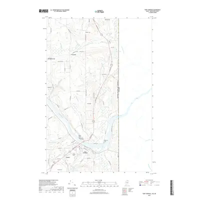
2018 Map of Fort Fairfield
USGS Topo · Published 2018About this map
The Aroostook River winds through this international border region, anchoring the town of Fort Fairfield. The landscape is defined by its agricultural character and prominent family-named landmarks like Irish Ridge, Stewart Hill, and Harvey Hill. For those researching local lineages, several burial sites are documented, including the Houghton Burial Ground, Riverside Cem, and First Saint Denis Cem.
Find a feature on this map
72 named features on this map. Tap any name to fly to it.
Don’t see what you’re looking for? This feature index may not catch every label — zoom into the map to look around manually.
Map Details
Editions of this 2018 Fort Fairfield Map
This is the sole edition of this map. No revisions or reprints were ever made.
Other maps of this area

1930 · Fort Fairfield
USGS Topo · 1:48,000

1933 · Fort Fairfield
USGS Topo · 1:62,500

1936 · Mars Hill
USGS Topo · 1:48,000

1940 · Mars Hill
USGS Topo · 1:62,500

1951 · Mars Hill
USGS Topo · 1:62,500

1951 · Fort Fairfield
USGS Topo · 1:62,500

1953 · Fort Fairfield NW
USGS Topo · 1:24,000
1953 · Limestone
USGS Topo · 1:24,000

1959 · Woodstock
USGS Topo · 1:250,000

1963 · Woodstock
USGS Topo · 1:250,000