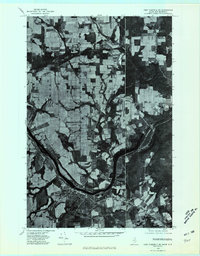
1975 Map of Fort Fairfield SE
USGS Topo · Published 1981About this map
Fort Fairfield occupies the southern bank of the Aroostook River in this mid-1970s orthophotoquad, which captures the agrarian intensity of this borderland region. The landscape is dominated by a tight patchwork of agricultural fields that extend right to the international boundary between the United States and Canada. Small rural nodes like Stevensville and Goodrich are clearly visible as they interface with the river and local roadways. This aerial perspective highlights the distinct drainage patterns of Limestone Stream and the broad bend of the river as it flows toward Tinker in New Brunswick. The transition from the developed town grid of Fort Fairfield to the expansive, cleared farming tracts northward to East Road provides a precise view of Aroostook County's land use before modern expansion.
Find a feature on this map
9 named features on this map. Tap any name to fly to it.
Don’t see what you’re looking for? This feature index may not catch every label — zoom into the map to look around manually.
Map Details
Editions of this 1975 Fort Fairfield SE Map
This is the sole edition of this map. No revisions or reprints were ever made.
Other maps of this area

1930 · Fort Fairfield
USGS Topo · 1:48,000

1933 · Fort Fairfield
USGS Topo · 1:62,500

1936 · Mars Hill
USGS Topo · 1:48,000

1940 · Mars Hill
USGS Topo · 1:62,500

1951 · Mars Hill
USGS Topo · 1:62,500

1951 · Fort Fairfield
USGS Topo · 1:62,500

1953 · Fort Fairfield NW
USGS Topo · 1:24,000
1953 · Limestone
USGS Topo · 1:24,000

1959 · Woodstock
USGS Topo · 1:250,000

1963 · Woodstock
USGS Topo · 1:250,000