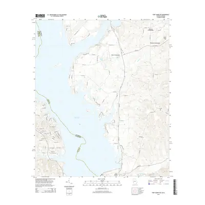
2014 Map of Fort Gaines NE
USGS Topo · Published 2014About this map
The Walter F George Reservoir dominates this landscape along the border of Georgia and Alabama, where the Chattahoochee River was transformed into a massive impoundment. On the Georgia side, the northern reaches of Fort Gaines meet a series of rural communities and crossroads. Local family history is preserved at New Lowell Cem, Mt Gilead Cem, and Campground Cem, which anchor the small settlements of Moores Crossroads and Days Crossroads. The transition from the water's edge to the uplands is marked by features like Johnny Moore Hill and Hartley Pond. The road network, including Ga-39 and Gilbertville Rd, illustrates how modern development like Pataula Heights Ln integrates with older agricultural routes near the winding Cemochechobee Cr.
Find a feature on this map
80 named features on this map. Tap any name to fly to it.
Don’t see what you’re looking for? This feature index may not catch every label — zoom into the map to look around manually.
Map Details
Editions of this 2014 Fort Gaines NE Map
This is the sole edition of this map. No revisions or reprints were ever made.
Other maps of this area

1953 · Dothan
USGS Topo · 1:250,000

1954 · Dothan
USGS Topo · 1:250,000

1955 · Dothan
USGS Topo · 1:250,000

1967 · Hatcher
USGS Topo · 1:24,000

1968 · Eufaula South
USGS Topo · 1:24,000

1969 · Fort Gaines
USGS Topo · 1:24,000

1969 · Fort Gaines NW
USGS Topo · 1:24,000

1969 · Fort Gaines NE
USGS Topo · 1:24,000

1969 · Abbeville East
USGS Topo · 1:24,000
1973 · Morris
USGS Topo · 1:24,000