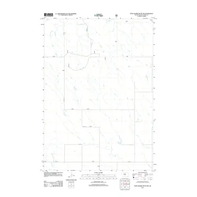
2012 Map of Fort George Butte SW
USGS Topo · Published 2012About this map
Stony Butte Cr and Nail Cr define the drainage patterns of this Lyman County landscape, which is largely characterized by open range and a sparse network of county infrastructure. The map reveals the layout of rural access roads including Co Hwy 25 and Co Rd 16, which cross the terrain to connect distant ranching or agricultural properties. This 2012 survey depicts the region as it transitioned into the early 21st century, showing how modern land management and boundary lines follow the natural watercourses like S Br Cedar Cr. The lack of dense settlement or named town centers emphasizes the vast, open nature of this portion of South Dakota, where topography and water sources govern the placement of local roads and remote outposts.
Find a feature on this map
15 named features on this map. Tap any name to fly to it.
Don’t see what you’re looking for? This feature index may not catch every label — zoom into the map to look around manually.
Map Details
Editions of this 2012 Fort George Butte SW Map
This is the sole edition of this map. No revisions or reprints were ever made.
Other maps of this area

1954 · Pierre
USGS Topo · 1:250,000

1955 · Martin
USGS Topo · 1:250,000

1958 · Pierre
USGS Topo · 1:250,000

1958 · Martin
USGS Topo · 1:250,000

1966 · Ft. George Butte SE
USGS Topo · 1:24,000

1967 · Ft. George Butte NW
USGS Topo · 1:24,000

1967 · Ft. George Butte SW
USGS Topo · 1:24,000
1967 · Ft. George Butte
USGS Topo · 1:24,000

1972 · Pierre 3 SE
USGS Topo · 1:24,000

1972 · Vivian
USGS Topo · 1:24,000