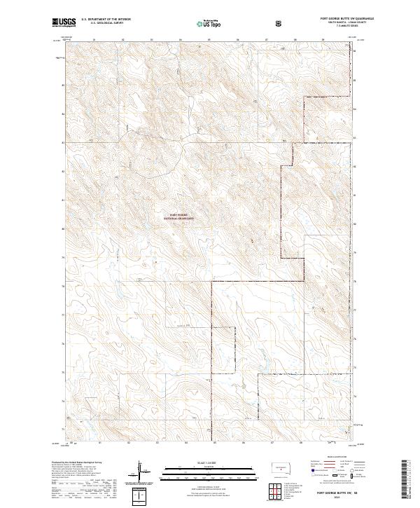
2021 Map of Fort George Butte SW
USGS Topo · Published 2021About this map
Fort Pierre National Grassland dominates this expanse of Lyman County, where the high plains landscape is defined by the drainages of the Missouri River watershed. The drainage network is anchored by Nail Cr in the east and the winding paths of Stony Butte Cr and S Br Cedar Cr. This map documents a sparsely populated but vital ranching and conservation corridor, characterized by the Public Land Survey System sections of Townships 106 through 108 North. Modern transit is provided by Co Hwy 25, which serves as a primary north-south axis through the grassland, while Co Rd 16 and 302nd Ave provide access to the remote interior sections. The survey details the subtle topographic variations of the butte country before the land drops toward the river valley to the east.
Find a feature on this map
14 named features on this map. Tap any name to fly to it.
Don’t see what you’re looking for? This feature index may not catch every label — zoom into the map to look around manually.
Map Details
Editions of this 2021 Fort George Butte SW Map
This is the sole edition of this map. No revisions or reprints were ever made.
Other maps of this area

1954 · Pierre
USGS Topo · 1:250,000

1955 · Martin
USGS Topo · 1:250,000

1958 · Pierre
USGS Topo · 1:250,000

1958 · Martin
USGS Topo · 1:250,000

1966 · Ft. George Butte SE
USGS Topo · 1:24,000

1967 · Ft. George Butte NW
USGS Topo · 1:24,000

1967 · Ft. George Butte SW
USGS Topo · 1:24,000
1967 · Ft. George Butte
USGS Topo · 1:24,000

1972 · Pierre 3 SE
USGS Topo · 1:24,000

1972 · Vivian
USGS Topo · 1:24,000