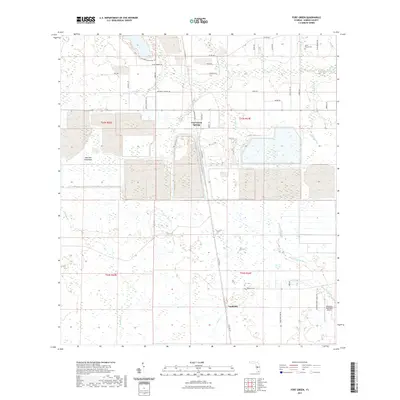
2021 Map of Fort Green
USGS Topo · Published 2021About this map
Fort Green Springs and Vandolah anchor this section of Hardee County, where the landscape is defined by an intricate network of wetlands and small tributaries. Waterways like Troublesome Creek, Gum Swamp Br, and Payne Cr wind through the terrain, suggesting a geography historically shaped by drainage and citrus or phosphate industries common to this part of Florida. The presence of Mitchell Hammock points to localized high ground amidst the predominantly marshy surroundings.
Find a feature on this map
48 named features on this map. Tap any name to fly to it.
Don’t see what you’re looking for? This feature index may not catch every label — zoom into the map to look around manually.
Map Details
Editions of this 2021 Fort Green Map
This is the sole edition of this map. No revisions or reprints were ever made.
Other maps of this area

1955 · Ft. Green
USGS Topo · 1:24,000

1955 · Bowling Green
USGS Topo · 1:24,000

1955 · Wauchula
USGS Topo · 1:24,000

1955 · Baird
USGS Topo · 1:24,000

1956 · Ona
USGS Topo · 1:24,000

1956 · Myakka Head
USGS Topo · 1:24,000

1956 · Duette NE
USGS Topo · 1:24,000

1956 · Zolfo Springs
USGS Topo · 1:24,000

1956 · Duette
USGS Topo · 1:24,000

1956 · Tampa
USGS Topo · 1:250,000