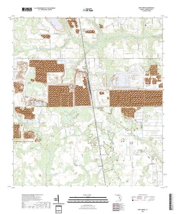
2024 Map of Fort Green
USGS Topo · Published 2024About this map
Fort Green and Fort Green Springs anchor this Hardee County landscape, where rural life is shaped by a dense network of tributaries including Payne Creek and Shirttail Branch. The settlement patterns here remain tied to local history, visible in the alignment of Baptist Church Rd and Methodist Church Rd, reflecting the community's traditional centers. In the northeast, the Olive Branch Cem and its namesake Olive Branch creek provide specific points of interest for genealogical research.
Find a feature on this map
47 named features on this map. Tap any name to fly to it.
Don’t see what you’re looking for? This feature index may not catch every label — zoom into the map to look around manually.
Map Details
Editions of this 2024 Fort Green Map
This is the sole edition of this map. No revisions or reprints were ever made.
Other maps of this area

1955 · Ft. Green
USGS Topo · 1:24,000

1955 · Bowling Green
USGS Topo · 1:24,000

1955 · Wauchula
USGS Topo · 1:24,000

1955 · Baird
USGS Topo · 1:24,000

1956 · Ona
USGS Topo · 1:24,000

1956 · Myakka Head
USGS Topo · 1:24,000

1956 · Duette NE
USGS Topo · 1:24,000

1956 · Zolfo Springs
USGS Topo · 1:24,000

1956 · Duette
USGS Topo · 1:24,000

1956 · Tampa
USGS Topo · 1:250,000