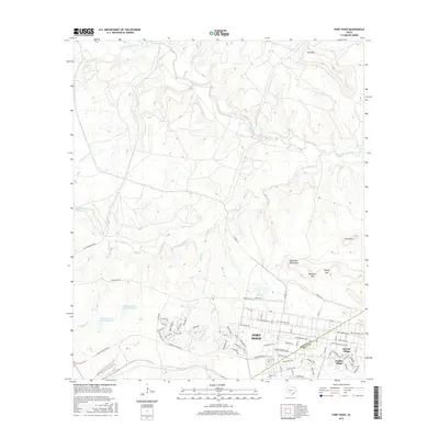
2016 Map of Fort Hood
USGS Topo · Published 2016About this map
The expansive military reservation of Fort Hood dominates this Central Texas landscape, where the administrative and residential grid meets the limestone uplands of the Lampasas Cut Plain. Organized housing areas like McNair Village and Chaffee Village sit at the edge of a dense network of specialized roads, including Tank Destroyer Blvd and the evocatively named Hell on Wheels Ave. This infrastructure contrasts sharply with the rugged terrain to the north, where Cowhouse Creek winds past distinctive topographic features such as Jack Mtn, Lone Mtn, and the Blackwell Mountains.
Find a feature on this map
85 named features on this map. Tap any name to fly to it.
Don’t see what you’re looking for? This feature index may not catch every label — zoom into the map to look around manually.
Map Details
Editions of this 2016 Fort Hood Map
This is the sole edition of this map. No revisions or reprints were ever made.
Other maps of this area

1894 · Gatesville
USGS Topo · 1:125,000

1930 · Killeen
USGS Topo · 1:62,500

1947 · Fort Hood
USGS Topo · 1:62,500

1947 · Fort Hood
USGS Topo · 1:24,000

1947 · Purmela
USGS Topo · 1:62,500

1947 · Post Oak Mountain
USGS Topo · 1:24,000

1947 · Killeen
USGS Topo · 1:62,500

1947 · McMillan Mountains
USGS Topo · 1:24,000

1947 · Pidcoke
USGS Topo · 1:24,000

1947 · North Fort Hood
USGS Topo · 1:24,000
Featured Places
- Chaffee Village, TX
- Comanche Village II, TX
- Comanche Village III East, TX
- Comanche Village III West, TX
- Saint Elijah Village, TX