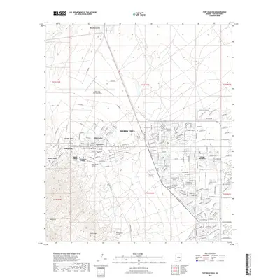
2018 Map of Fort Huachuca
USGS Topo · Published 2018About this map
Sierra Vista and its surrounding residential developments are extensively mapped in this late-period survey, showing a landscape defined by both military infrastructure and rapid suburban expansion. The northern reaches are dominated by the Sierra Vista Municipal Airport-Libby Army Airfield, while the city core is a dense grid of neighborhoods like Miles Manor, Apache Flats, and Fry. The map documents the intricate street networks of De Anza Village and Village Meadows, providing a detailed record of the area's late 20th-century growth patterns.
Find a feature on this map
115 named features on this map. Tap any name to fly to it.
Don’t see what you’re looking for? This feature index may not catch every label — zoom into the map to look around manually.
Map Details
Editions of this 2018 Fort Huachuca Map
This is the sole edition of this map. No revisions or reprints were ever made.
Other maps of this area

1914 · Hereford
USGS Topo · 1:125,000

1915 · Benson
USGS Topo · 1:125,000

1922 · Sunnyside
USGS Topo · 1:62,500

1932 · Stark
USGS Topo · 1:62,500

1932 · Fairbank
USGS Topo · 1:62,500

1938 · Huachuca
USGS Topo · 1:62,500

1938 · Sunnyside
USGS Topo · 1:62,500

1943 · Benson
USGS Topo · 1:125,000

1948 · Huachuca Peak
USGS Topo · 1:24,000

1948 · Fort Huachuca NE
USGS Topo · 1:24,000
Featured Places
- Sierra Vista, AZ
- Huachuca City, AZ
- West Pershing Plaza, Sierra Vista
- Village Meadows, Sierra Vista
- Apache Flats, Sierra Vista