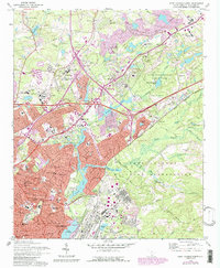
1972 Map of Fort Jackson North
USGS Topo · Published 1990About this map
Fort Jackson Military Reservation occupies a massive portion of the eastern landscape, defined by a complex network of training grounds and firing ranges. To the west, the growing suburbs of Columbia and Forest Acres show a mid-century transition from open land to dense residential development. This era is marked by a significant concentration of public and charitable institutions, including the State Hospital, the County Prison Camp, and several residential youth facilities such as the Carolina Childrens Home and Epworth Childrens Home. The hydrology of the area is heavily modified, with a series of artificial lakes and reservoirs including Windsor Lake, Carys Lakes, and Spring Lake that define the character of neighborhoods like Arcadia Lakes. Leisure and conservation are anchored by the expansive Sesquicentennial State Park, while the rise of the interstate system is evidenced by numerous new interchanges cutting through the traditional landscape.
Find a feature on this map
93 named features on this map. Tap any name to fly to it.
Don’t see what you’re looking for? This feature index may not catch every label — zoom into the map to look around manually.
Map Details
Editions of this 1972 Fort Jackson North Map
2 editions found
Other maps of this area

1904 · Columbia
USGS Topo · 1:125,000

1935 · Killian
USGS Topo · 1:48,000

1937 · Killian
USGS Topo · 1:62,500

1941 · Spartanburg
USGS Topo · 1:250,000

1942 · Camden
USGS Topo · 1:125,000

1944 · Edmund
USGS Topo · 1:62,500

1947 · Columbia North
USGS Topo · 1:24,000

1948 · Hopkins
USGS Topo · 1:62,500

1948 · Columbia North
USGS Topo · 1:24,000

1949 · Irmo NE
USGS Topo · 1:24,000