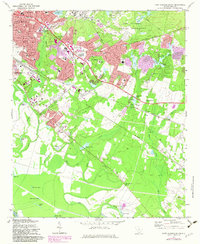
1972 Map of Fort Jackson South
USGS Topo · Published 1983About this map
The sprawling grounds of the Fort Jackson Military Reservation dominate the northeast, where the landscape transitions from military training grounds to the growing suburbs of Columbia. This 1972 survey, updated with 1982 photorevisions, captures a period of significant institutional expansion, including the VA Hospital and the Midland Technical Education Center. Further south, the map reveals the rural character of Richland County along the Southern Railway and Seaboard Coast Line tracks. Settlement patterns follow these rail corridors through communities like Lykes and Hopkins, while a dense network of country churches such as Zion Chapel No 2 Ch and Pine Bluff Ch anchors the outlying areas. Water is central to the landscape, from the large ponds like Adams Pond and Pinewood Lake to the meandering course of Gills Creek and Mill Creek, which define the low-lying southern terrain.
Find a feature on this map
79 named features on this map. Tap any name to fly to it.
Don’t see what you’re looking for? This feature index may not catch every label — zoom into the map to look around manually.
Map Details
Editions of this 1972 Fort Jackson South Map
3 editions found
Other maps of this area

1904 · Columbia
USGS Topo · 1:125,000

1935 · Killian
USGS Topo · 1:48,000

1937 · Killian
USGS Topo · 1:62,500

1941 · Spartanburg
USGS Topo · 1:250,000

1942 · Camden
USGS Topo · 1:125,000

1944 · Edmund
USGS Topo · 1:62,500

1947 · Columbia North
USGS Topo · 1:24,000

1948 · Hopkins
USGS Topo · 1:62,500

1948 · Columbia North
USGS Topo · 1:24,000

1953 · Messers Pond
USGS Topo · 1:24,000