
2011 Map of Fort Kipp
USGS Topo · Published 2011About this map
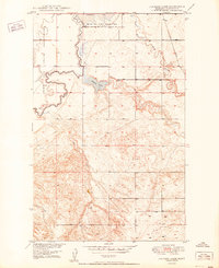
Fort Kipp and the settlement of Blair anchor this section of Northeast Montana where the winding Big Muddy Creek makes its final descent toward the Missouri River. The landscape is defined by the sharp meanders of the creek as it cuts through the valley, joined by tributaries like Lone Tree Creek and Scott Creek. Cultural markers are concentrated along the southern corridor near the river, where Indian Road 1 connects the small communities.
Find a feature on this map
12 named features on this map. Tap any name to fly to it.
Don’t see what you’re looking for? This feature index may not catch every label — zoom into the map to look around manually.
Map Details
Editions of this 2011 Fort Kipp Map
This is the sole edition of this map. No revisions or reprints were ever made.
Other maps of this area

1909 · Smoke Creek
USGS Topo · 1:62,500

1912 · Smoke Creek
USGS Topo · 1:62,500

1914 · Brockton
USGS Topo · 1:62,500

1914 · Homestead
USGS Topo · 1:62,500

1947 · Rocky Point
USGS Topo · 1:24,000

1948 · Rocky Point
USGS Topo · 1:24,000

1948 · Fort Kipp
USGS Topo · 1:24,000

1949 · Fort Kipp
USGS Topo · 1:24,000

1949 · Johnson Lake
USGS Topo · 1:24,000
1950 · Johnson Lake
USGS Topo · 1:24,000
Featured Places
- Fort Kipp District, MT
- Fort Kipp, Fort Kipp District
- Roosevelt County, MT
- Richland County, MT
- United States