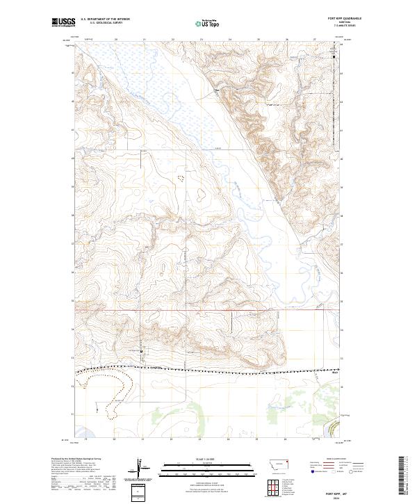
2024 Map of Fort Kipp
USGS Topo · Published 2024About this map
Fort Kipp and the neighboring settlement of Blair sit within a landscape dominated by the meandering course of Big Muddy Creek. This 2024 map illustrates the modern road network on the Fort Peck Reservation, including Bia Rte 1 and Bia Rte 26, which connect these small rural communities across the Missouri River valley floor. Genealogy researchers can identify two specific burial grounds: Fort Kipp Cem just north of the townsite and the Friedens Gemeinde Cem in the northeastern corner of the quadrangle.
Find a feature on this map
26 named features on this map. Tap any name to fly to it.
Don’t see what you’re looking for? This feature index may not catch every label — zoom into the map to look around manually.
Map Details
Editions of this 2024 Fort Kipp Map
This is the sole edition of this map. No revisions or reprints were ever made.
Other maps of this area

1909 · Smoke Creek
USGS Topo · 1:62,500

1912 · Smoke Creek
USGS Topo · 1:62,500

1914 · Brockton
USGS Topo · 1:62,500

1914 · Homestead
USGS Topo · 1:62,500

1947 · Rocky Point
USGS Topo · 1:24,000

1948 · Rocky Point
USGS Topo · 1:24,000

1948 · Fort Kipp
USGS Topo · 1:24,000

1949 · Fort Kipp
USGS Topo · 1:24,000

1949 · Johnson Lake
USGS Topo · 1:24,000
1950 · Johnson Lake
USGS Topo · 1:24,000
Featured Places
- Fort Kipp District, MT
- Fort Kipp, Fort Kipp District
- Roosevelt County, MT
- Richland County, MT
- United States