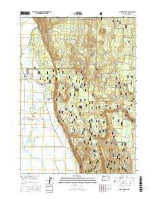
2017 Map of Fort Klamath
USGS Topo · Published 2017About this map
Wood River Springs emerge at the foot of Sun Mtn, feeding a complex network of waterways that define the northern Wood River Valley. This landscape transitions from the dense timberlands of the Winema National Forest to an intricate system of agricultural and resource-management channels, including the Melhase Ditch and Fort Cr Ditch. The settlement of Fort Klamath serves as the central point of human activity, situated near the Middley Bridge and the Fort Klamath Cem.
Find a feature on this map
36 named features on this map. Tap any name to fly to it.
Don’t see what you’re looking for? This feature index may not catch every label — zoom into the map to look around manually.
Map Details
Editions of this 2017 Fort Klamath Map
This is the sole edition of this map. No revisions or reprints were ever made.
Other maps of this area

1889 · Klamath
USGS Topo · 1:250,000

1891 · Ashland
USGS Topo · 1:250,000

1893 · Ashland
USGS Topo · 1:250,000

1894 · Klamath
USGS Topo · 1:250,000

1897 · Ashland
USGS Topo · 1:250,000

1955 · Pelican Butte
USGS Topo · 1:62,500

1955 · Klamath Falls
USGS Topo · 1:250,000

1955 · Medford
USGS Topo · 1:250,000

1957 · Medford
USGS Topo · 1:250,000

1957 · Chiloquin
USGS Topo · 1:62,500