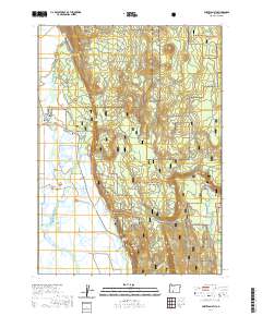
2020 Map of Fort Klamath
USGS Topo · Published 2020About this map
Fort Klamath and the surrounding Wood River Valley are defined by a complex network of spring-fed waters and irrigation works. This high-country landscape is anchored by the historical settlement of Fort Klamath, where the Fort Klamath Cem serves as a primary point of interest for genealogists and local historians. The terrain transitions from the marshy lowlands along the Wood River and Crooked Cr toward the timbered slopes of the Winema National Forest, featuring prominent rises such as Sugar Hill and Agency Hill. Water management is central to the area's layout, visible through features like the Melhase Ditch, Wood River Canal, and the Fort Cr Ditch. Recreational and natural landmarks, including the Spring Creek C G and various cold-water sources like Tecumseh Spring and Sun Mountain Spring, illustrate the intersection of mountain geography and the historical settlement patterns of Klamath County.
Find a feature on this map
45 named features on this map. Tap any name to fly to it.
Don’t see what you’re looking for? This feature index may not catch every label — zoom into the map to look around manually.
Map Details
Editions of this 2020 Fort Klamath Map
This is the sole edition of this map. No revisions or reprints were ever made.
Other maps of this area

1889 · Klamath
USGS Topo · 1:250,000

1891 · Ashland
USGS Topo · 1:250,000

1893 · Ashland
USGS Topo · 1:250,000

1894 · Klamath
USGS Topo · 1:250,000

1897 · Ashland
USGS Topo · 1:250,000

1955 · Pelican Butte
USGS Topo · 1:62,500

1955 · Klamath Falls
USGS Topo · 1:250,000

1955 · Medford
USGS Topo · 1:250,000

1957 · Medford
USGS Topo · 1:250,000

1957 · Chiloquin
USGS Topo · 1:62,500