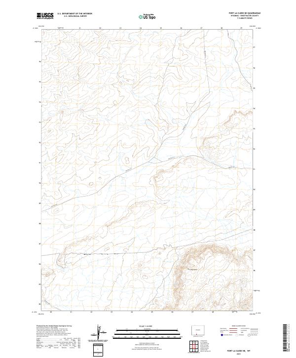
2021 Map of Fort La Clede NE
USGS Topo · Published 2021About this map
The Haystacks dominate the southern reaches of this terrain, where the high desert landscape is defined by the complex contours of Sweetwater County. This 2021 survey reveals a remote section of the public land system, structured by the Bureau of Land Management's network of unpaved access routes including Blm Rd 4410 and Blm Rd 4411. The map detail emphasizes the open-range character of the region, where topographical changes are primarily documented through elevation intervals and isolated geological features rather than human settlements. Researchers and land managers can trace the precise township and range boundaries, such as t17n r97w, which partition the arid basins and ridges typical of this high-altitude Wyoming environment.
Find a feature on this map
10 named features on this map. Tap any name to fly to it.
Don’t see what you’re looking for? This feature index may not catch every label — zoom into the map to look around manually.
Map Details
Editions of this 2021 Fort La Clede NE Map
This is the sole edition of this map. No revisions or reprints were ever made.
Other maps of this area

1954 · Rock Springs
USGS Topo · 1:250,000

1958 · Rock Springs
USGS Topo · 1:250,000

1962 · Rock Springs
USGS Topo · 1:250,000

1970 · Red Desert SW
USGS Topo · 1:24,000
1970 · Kinney Spring
USGS Topo · 1:24,000

1970 · Table Rock
USGS Topo · 1:24,000

1970 · Manuel Gap
USGS Topo · 1:24,000
1970 · Barrel Springs SW
USGS Topo · 1:24,000

1970 · J O Dugway
USGS Topo · 1:24,000

1970 · Fort La Clede NE
USGS Topo · 1:24,000