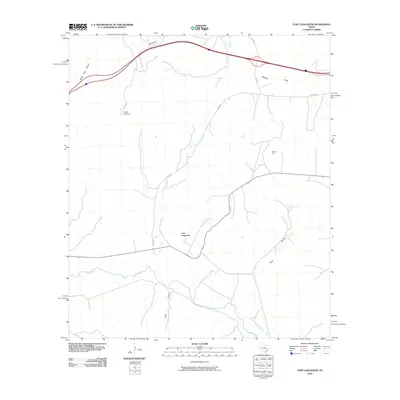
2010 Map of Fort Lancaster
USGS Topo · Published 2010About this map
Fort Lancaster stands as a focal point in this West Texas landscape, positioned near the confluence where Live Oak Creek meets the Pecos River. The terrain is defined by a network of drainage systems and draws, including Musk Hog Canyon, J M Canyon, and Mailbox Draw, which reveal the complex topography of the Edwards Plateau. Evidence of ranching and resource extraction is scattered across the quadrangle, notably at Divide Windmill and the Cox Oil Field. The path of Live Oak Rd provides the primary transit artery through this arid region, tracing the natural contours of the land. This map documents a sparsely populated but geographically significant portion of Crockett County, where historical military outposts and modern petroleum interests intersect.
Find a feature on this map
11 named features on this map. Tap any name to fly to it.
Don’t see what you’re looking for? This feature index may not catch every label — zoom into the map to look around manually.
Map Details
Editions of this 2010 Fort Lancaster Map
This is the sole edition of this map. No revisions or reprints were ever made.
Other maps of this area

1929 · Sheffield
USGS Topo · 1:125,000

1954 · Sonora
USGS Topo · 1:250,000

1958 · Sonora
USGS Topo · 1:250,000

1967 · Owens Creek SE
USGS Topo · 1:24,000

1967 · Burnt Canyon
USGS Topo · 1:24,000

1967 · Deer Canyon
USGS Topo · 1:24,000

1967 · Fort Lancaster
USGS Topo · 1:24,000

1967 · Bachelor Hill
USGS Topo · 1:24,000

1967 · Sheffield SE
USGS Topo · 1:24,000

1967 · Dead Man Canyon
USGS Topo · 1:24,000