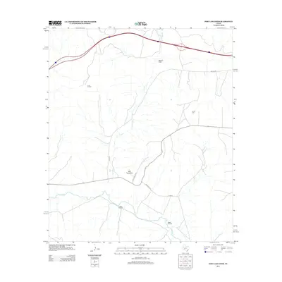
2012 Map of Fort Lancaster
USGS Topo · Published 2012About this map
Fort Lancaster stands at a historic crossroads where the drainage of Live Oak Cr meets the Pecos River valley. This 2012 survey illustrates a landscape of deep Texas canyons and draws, including Mailbox Draw, Loftin Canyon, and Scott Canyon. The infrastructure reflects a mix of heritage and industry, anchored by the namesake frontier site and modern energy extraction at the Cox Oil Field.
Find a feature on this map
13 named features on this map. Tap any name to fly to it.
Don’t see what you’re looking for? This feature index may not catch every label — zoom into the map to look around manually.
Map Details
Editions of this 2012 Fort Lancaster Map
This is the sole edition of this map. No revisions or reprints were ever made.
Other maps of this area

1929 · Sheffield
USGS Topo · 1:125,000

1954 · Sonora
USGS Topo · 1:250,000

1958 · Sonora
USGS Topo · 1:250,000

1967 · Owens Creek SE
USGS Topo · 1:24,000

1967 · Burnt Canyon
USGS Topo · 1:24,000

1967 · Deer Canyon
USGS Topo · 1:24,000

1967 · Fort Lancaster
USGS Topo · 1:24,000

1967 · Bachelor Hill
USGS Topo · 1:24,000

1967 · Sheffield SE
USGS Topo · 1:24,000

1967 · Dead Man Canyon
USGS Topo · 1:24,000