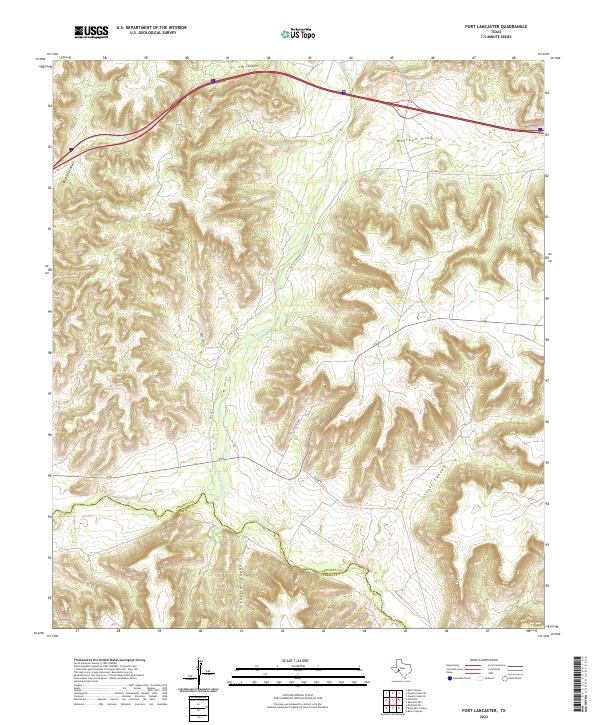
2022 Map of Fort Lancaster
USGS Topo · Published 2022About this map
The Pecos River serves as the defining geographical and political boundary on this map, marking the border between Crockett County and Terrell County in West Texas. This arid landscape is deeply dissected by a network of drainage features, most notably the winding path of Live Oak Cr and several named draws and canyons. The terrain is characterized by high, flat-topped mesas and deep relief, where J M Canyon, Musk Hog Canyon, and Scott Canyon reveal the complex erosion patterns typical of the Edwards Plateau. Modern ranching and transport infrastructure is evident through the network of rural routes such as Live Oak Rd, Ft Lancaster Rd, and Foley Rd, providing a detailed view of the corridor surrounding the namesake frontier post area.
Find a feature on this map
13 named features on this map. Tap any name to fly to it.
Don’t see what you’re looking for? This feature index may not catch every label — zoom into the map to look around manually.
Map Details
Editions of this 2022 Fort Lancaster Map
This is the sole edition of this map. No revisions or reprints were ever made.
Other maps of this area

1929 · Sheffield
USGS Topo · 1:125,000

1954 · Sonora
USGS Topo · 1:250,000

1958 · Sonora
USGS Topo · 1:250,000

1967 · Owens Creek SE
USGS Topo · 1:24,000

1967 · Burnt Canyon
USGS Topo · 1:24,000

1967 · Deer Canyon
USGS Topo · 1:24,000

1967 · Fort Lancaster
USGS Topo · 1:24,000

1967 · Bachelor Hill
USGS Topo · 1:24,000

1967 · Sheffield SE
USGS Topo · 1:24,000

1967 · Dead Man Canyon
USGS Topo · 1:24,000