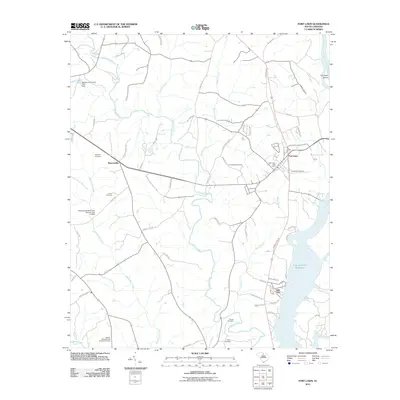
2011 Map of Fort Lawn
USGS Topo · Published 2011About this map
Fort Lawn and its surrounding rural landscapes are defined by a complex network of waterways feeding into the Fishing Creek Reservoir and the Catawba River. This 2011 topographic survey highlights a mix of small settlements and scattered family burial grounds, such as the Blakes, Caldwells, and Strouds Cemetery and Howze Cemetery, which provide invaluable touchpoints for genealogists researching Chester County lineages. The landscape is deeply incised by Fishing Creek and its many tributaries, including Tinkers Creek and Beaverdam Creek.
Find a feature on this map
63 named features on this map. Tap any name to fly to it.
Don’t see what you’re looking for? This feature index may not catch every label — zoom into the map to look around manually.
Map Details
Editions of this 2011 Fort Lawn Map
This is the sole edition of this map. No revisions or reprints were ever made.
Other maps of this area

1941 · Spartanburg
USGS Topo · 1:250,000

1949 · Rock Hill
USGS Topo · 1:62,500

1953 · Spartanburg
USGS Topo · 1:250,000

1960 · Spartanburg
USGS Topo · 1:250,000

1963 · Spartanburg
USGS Topo · 1:250,000

1964 · Spartanburg
USGS Topo · 1:250,000

1968 · Van Wyck
USGS Topo · 1:24,000

1968 · Catawba
USGS Topo · 1:24,000

1968 · Lancaster SE
USGS Topo · 1:24,000
1969 · Lancaster
USGS Topo · 1:24,000