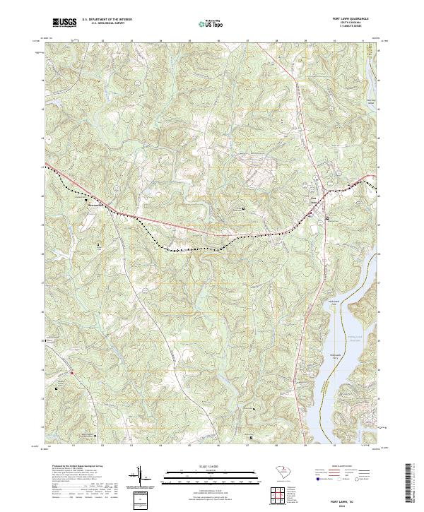
2024 Map of Fort Lawn
USGS Topo · Published 2024About this map
Fort Lawn serves as a central hub on the boundary of Chester and Lancaster counties, where the Catawba River Rd follows the winding path of the river. The landscape is defined by the expansive Fishing Creek Reservoir and the intricate drainage of Fishing Creek and its many tributaries like Beaverdam Creek and Dairy Branch. For genealogists, the map is remarkably dense with family-named landmarks and resting places, ranging from the William Martin Grave to the Blake Caldwell and Stroud Cem. Settlement patterns follow the ridge lines and creek valleys, with Bascomville and Union established alongside a network of older thoroughfares like Wylies Mill Rd and Mountain Gap Rd. Historical river crossings, including McDonalds Ford and McDonalds Ferry, point to an era of travel before modern bridging, while local spiritual centers like Mount Prospect Church underscore the area's rural community roots.
Find a feature on this map
89 named features on this map. Tap any name to fly to it.
Don’t see what you’re looking for? This feature index may not catch every label — zoom into the map to look around manually.
Map Details
Editions of this 2024 Fort Lawn Map
This is the sole edition of this map. No revisions or reprints were ever made.
Other maps of this area

1941 · Spartanburg
USGS Topo · 1:250,000

1949 · Rock Hill
USGS Topo · 1:62,500

1953 · Spartanburg
USGS Topo · 1:250,000

1960 · Spartanburg
USGS Topo · 1:250,000

1963 · Spartanburg
USGS Topo · 1:250,000

1964 · Spartanburg
USGS Topo · 1:250,000

1968 · Van Wyck
USGS Topo · 1:24,000

1968 · Catawba
USGS Topo · 1:24,000

1968 · Lancaster SE
USGS Topo · 1:24,000
1969 · Lancaster
USGS Topo · 1:24,000