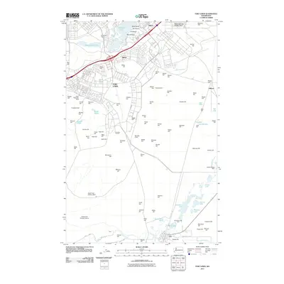
2011 Map of Fort Lewis
USGS Topo · Published 2011About this map
Fort Lewis serves as the central focal point of this military and prairie landscape in western Washington, punctuated by dozens of named hills that reveal the area's glacial topography. The installation's southern reaches give way to a complex network of wetlands and small lakes, including Muck Lake and Chambers Lake, where the Chambers Lake Dam regulates local hydrology. This 2011 survey captures the established footprint of the base alongside the civilian communities of Roy and Tillicum.
Find a feature on this map
105 named features on this map. Tap any name to fly to it.
Don’t see what you’re looking for? This feature index may not catch every label — zoom into the map to look around manually.
Map Details
Editions of this 2011 Fort Lewis Map
This is the sole edition of this map. No revisions or reprints were ever made.
Other maps of this area

1897 · Tacoma
USGS Topo · 1:125,000

1900 · Tacoma
USGS Topo · 1:125,000

1916 · Chehalis
USGS Topo · 1:125,000

1937 · Eatonville
USGS Topo · 1:125,000

1940 · Anderson Island
USGS Topo · 1:62,500

1941 · Tanwax Lake
USGS Topo · 1:62,500

1941 · Tacoma South
USGS Topo · 1:62,500

1944 · Tacoma South
USGS Topo · 1:62,500

1944 · Yelm
USGS Topo · 1:62,500

1944 · Ohop Valley
USGS Topo · 1:62,500