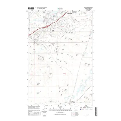
2017 Map of Fort Lewis
USGS Topo · Published 2017About this map
Fort Lewis and the surrounding Pierce County landscape are defined by a complex network of glacial lakes and military infrastructure. The sprawling installation centers on Gray Army Airfield and the residential core of North Fort Lewis, while residential pockets like Tillicum and American Lake Garden Tract border the prominent American Lake. The terrain is characterized by a high density of named hills, such as Miller Hill and Davis Hill, which are interspersed among sensitive wetlands including Mackay Marsh and Elliot Marsh. To the south, the landscape opens into the Ninety-first Division Prairie, where smaller water bodies like Muck Lake and Chambers Lake drain toward Muck Cr. This 2017 survey reflects the modern configuration of one of the Pacific Northwest's most significant military corridors, balancing active training grounds with established communities like Hillhurst and Roy.
Find a feature on this map
224 named features on this map. Tap any name to fly to it.
Don’t see what you’re looking for? This feature index may not catch every label — zoom into the map to look around manually.
Map Details
Editions of this 2017 Fort Lewis Map
This is the sole edition of this map. No revisions or reprints were ever made.
Other maps of this area

1897 · Tacoma
USGS Topo · 1:125,000

1900 · Tacoma
USGS Topo · 1:125,000

1916 · Chehalis
USGS Topo · 1:125,000

1937 · Eatonville
USGS Topo · 1:125,000

1940 · Anderson Island
USGS Topo · 1:62,500

1941 · Tanwax Lake
USGS Topo · 1:62,500

1941 · Tacoma South
USGS Topo · 1:62,500

1944 · Tacoma South
USGS Topo · 1:62,500

1944 · Yelm
USGS Topo · 1:62,500

1944 · Ohop Valley
USGS Topo · 1:62,500