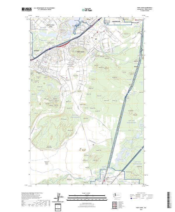
2023 Map of Fort Lewis
USGS Topo · Published 2023About this map
Joint Base Lewis-McChord dominates the landscape of this Pierce County survey, showcasing the expansive military infrastructure of North Fort Lewis and the surrounding installations. The map details a complex network of internal roads such as 41st Division Rd and Garcia Blvd, alongside operational facilities like Gray Army Airfield. Beyond the military boundaries, the residential and commercial areas of Lakewood, Dupont, and Tillicum are visible, linked by the heavy corridor of I-5 and the BNSF Railway.
Find a feature on this map
228 named features on this map. Tap any name to fly to it.
Don’t see what you’re looking for? This feature index may not catch every label — zoom into the map to look around manually.
Map Details
Editions of this 2023 Fort Lewis Map
This is the sole edition of this map. No revisions or reprints were ever made.
Other maps of this area

1897 · Tacoma
USGS Topo · 1:125,000

1900 · Tacoma
USGS Topo · 1:125,000

1916 · Chehalis
USGS Topo · 1:125,000

1937 · Eatonville
USGS Topo · 1:125,000

1940 · Anderson Island
USGS Topo · 1:62,500

1941 · Tanwax Lake
USGS Topo · 1:62,500

1941 · Tacoma South
USGS Topo · 1:62,500

1944 · Tacoma South
USGS Topo · 1:62,500

1944 · Yelm
USGS Topo · 1:62,500

1944 · Ohop Valley
USGS Topo · 1:62,500