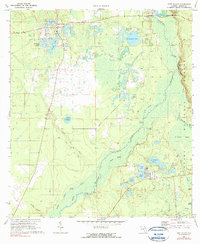
1970 Map of Fort Mc Coy
USGS Topo · Published 1990About this map
Fort McCoy serves as the primary settlement in this north-central Florida landscape, surrounded by a complex network of wetlands and river landings. The Oklawaha River meanders through the center of the sheet, its course defined by numerous landings such as Sunday Bluff, Gores Landing, and Osceola Landing, which hint at the region's historic river-based transport and fishing economy. To the east, the Ocala National Forest covers a significant portion of the terrain, marked by Mason Bay and the expansive Parramore Prairie.
Find a feature on this map
42 named features on this map. Tap any name to fly to it.
Don’t see what you’re looking for? This feature index may not catch every label — zoom into the map to look around manually.
Map Details
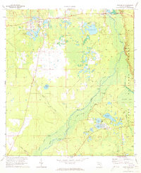
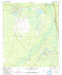
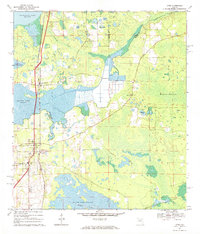
Editions of this 1970 Fort Mc Coy Map
3 editions found
Other maps of this area

1893 · Citra
USGS Topo · 1:62,500

1895 · Citra
USGS Topo · 1:62,500

1895 · Ocala
USGS Topo · 1:62,500

1954 · Gainesville
USGS Topo · 1:250,000

1954 · Daytona Beach
USGS Topo · 1:250,000

1958 · Daytona Beach
USGS Topo · 1:250,000

1958 · Gainesville
USGS Topo · 1:250,000

1959 · Gainesville
USGS Topo · 1:250,000

1964 · Daytona Beach
USGS Topo · 1:250,000
1967 · Citra
USGS Topo · 1:24,000