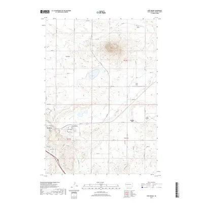
2017 Map of Fort Meade
USGS Topo · Published 2017About this map
Bear Butte dominates the northern landscape of this Meade County survey, standing as a prominent geologic landmark above the surrounding plains. The settlement patterns of the 21st century are clearly visible, anchored by the historic grounds of Fort Meade and the adjacent city of Sturgis. This area is defined by a unique mix of military history, aviation, and recreation, featuring multiple landing strips including Sturgis Municipal Airport and the Bruch Ranch Airport.
Find a feature on this map
57 named features on this map. Tap any name to fly to it.
Don’t see what you’re looking for? This feature index may not catch every label — zoom into the map to look around manually.
Map Details
Editions of this 2017 Fort Meade Map
This is the sole edition of this map. No revisions or reprints were ever made.
Other maps of this area

1893 · Rapid
USGS Topo · 1:125,000

1894 · Deadwood
USGS Topo · 1:125,000

1898 · Rapid
USGS Topo · 1:125,000

1899 · Sturgis
USGS Topo · 1:62,500

1901 · Deadwood
USGS Topo · 1:125,000

1903 · Rapid
USGS Topo · 1:125,000

1905 · Saint Onge
USGS Topo · 1:62,500

1906 · Vale
USGS Topo · 1:62,500

1907 · Belle Fourche
USGS Topo · 1:125,000

1913 · Newell
USGS Topo · 1:125,000