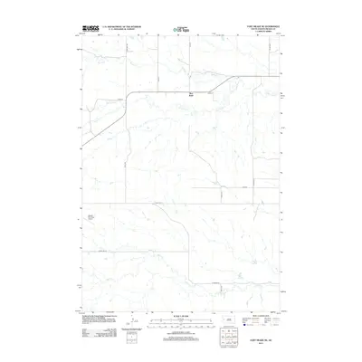
2012 Map of Fort Meade NE
USGS Topo · Published 2012About this map
Bear Butte serves as the focal point of this Meade County landscape, where the prairie begins to ripple with the drainage networks of the Black Hills foothills. The terrain is defined by a series of eastward-flowing watercourses, including Spring Cr and the winding path of Bear Butte Cr. These streams cut through a sparsely settled region primarily organized by a grid of rural routes such as Alkali Rd and Nine Mile Rd.
Find a feature on this map
17 named features on this map. Tap any name to fly to it.
Don’t see what you’re looking for? This feature index may not catch every label — zoom into the map to look around manually.
Map Details
Editions of this 2012 Fort Meade NE Map
This is the sole edition of this map. No revisions or reprints were ever made.
Other maps of this area

1893 · Rapid
USGS Topo · 1:125,000

1898 · Rapid
USGS Topo · 1:125,000

1903 · Rapid
USGS Topo · 1:125,000

1906 · Vale
USGS Topo · 1:62,500

1913 · Newell
USGS Topo · 1:125,000

1951 · Volunteer
USGS Topo · 1:24,000

1951 · Vale
USGS Topo · 1:24,000

1951 · Vale SE
USGS Topo · 1:24,000

1951 · Vale
USGS Topo · 1:62,500

1953 · Rapid City 1 SW
USGS Topo · 1:24,000