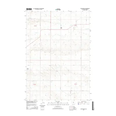
2015 Map of Fort Meade NE
USGS Topo · Published 2015About this map
Bear Butte dominates the northern landscape of this Meade County survey, serving as a prominent geographical anchor amidst the drainage basins of Spring Cr and Bear Butte Cr. The terrain reflects the transition from the high plains into more complex topographical folds, with Cottle Cr and Alkali Cr cutting through the southern sections. This area shows a sparse but organized grid of rural infrastructure, where long-established routes like Nine Mile Rd and Alkali Rd facilitate travel between scattered agricultural holdings. The presence of the Sturgis Municipal Airport on the western edge of the quadrangle highlights the intersection of traditional rangeland with modern transportation needs. Local history and land use patterns are further evidenced by the network of section lines and roads such as Titan Rd and 207th St, which trace the legacy of the Public Land Survey System in South Dakota.
Find a feature on this map
21 named features on this map. Tap any name to fly to it.
Don’t see what you’re looking for? This feature index may not catch every label — zoom into the map to look around manually.
Map Details
Editions of this 2015 Fort Meade NE Map
This is the sole edition of this map. No revisions or reprints were ever made.
Other maps of this area

1893 · Rapid
USGS Topo · 1:125,000

1898 · Rapid
USGS Topo · 1:125,000

1903 · Rapid
USGS Topo · 1:125,000

1906 · Vale
USGS Topo · 1:62,500

1913 · Newell
USGS Topo · 1:125,000

1951 · Volunteer
USGS Topo · 1:24,000

1951 · Vale
USGS Topo · 1:24,000

1951 · Vale SE
USGS Topo · 1:24,000

1951 · Vale
USGS Topo · 1:62,500

1953 · Rapid City 1 SW
USGS Topo · 1:24,000