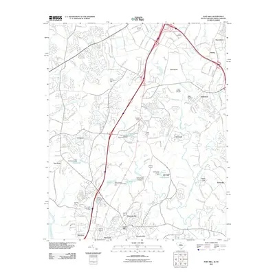
2011 Map of Fort Mill
USGS Topo · Published 2011About this map
The South Carolina North Carolina state line bisects this landscape, illustrating the suburban expansion between Fort Mill and Pineville during the early 21st century. The geography is defined by a dense network of residential developments such as Ravenwood, Carowood, and Eden Gardens, woven between significant water bodies like Lake Haigler and Lake Frances. In the northern section, the Dinkins Cemetery remains a point of genealogical interest amidst the growing infrastructure of the Charlotte metro fringe.
Find a feature on this map
58 named features on this map. Tap any name to fly to it.
Don’t see what you’re looking for? This feature index may not catch every label — zoom into the map to look around manually.
Map Details
Editions of this 2011 Fort Mill Map
This is the sole edition of this map. No revisions or reprints were ever made.
Other maps of this area

1905 · Charlotte
USGS Topo · 1:48,000

1907 · Charlotte
USGS Topo · 1:62,500

1941 · Charlotte
USGS Topo · 1:125,000

1941 · Spartanburg
USGS Topo · 1:250,000

1942 · Charlotte
USGS Topo · 1:125,000

1947 · Clover
USGS Topo · 1:62,500

1948 · Charlotte East
USGS Topo · 1:24,000

1948 · Charlotte West
USGS Topo · 1:24,000

1949 · Clover
USGS Topo · 1:62,500

1949 · Charlotte West
USGS Topo · 1:24,000