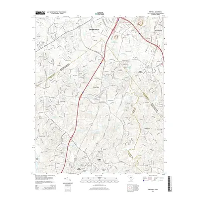
2014 Map of Fort Mill
USGS Topo · Published 2014About this map
The North Carolina and South Carolina state line bisects this 2014 survey, highlighting the suburban expansion of the Charlotte metropolitan area into York and Lancaster Counties. In North Carolina, the town of Pineville sits as a central hub, flanked by neighborhoods like Sterling and Sharonbrook. Historical markers of the landscape remain, such as the Dinkins Cem near Sugar Creek. The map documents a complex aquatic geography of natural and man-made water bodies, including Crystal Springs Lake, Lake Patricia, and Lake Haigler, which serve the recreational and residential developments of the region.
Find a feature on this map
54 named features on this map. Tap any name to fly to it.
Don’t see what you’re looking for? This feature index may not catch every label — zoom into the map to look around manually.
Map Details
Editions of this 2014 Fort Mill Map
This is the sole edition of this map. No revisions or reprints were ever made.
Other maps of this area

1905 · Charlotte
USGS Topo · 1:48,000

1907 · Charlotte
USGS Topo · 1:62,500

1941 · Charlotte
USGS Topo · 1:125,000

1941 · Spartanburg
USGS Topo · 1:250,000

1942 · Charlotte
USGS Topo · 1:125,000

1947 · Clover
USGS Topo · 1:62,500

1948 · Charlotte East
USGS Topo · 1:24,000

1948 · Charlotte West
USGS Topo · 1:24,000

1949 · Clover
USGS Topo · 1:62,500

1949 · Charlotte West
USGS Topo · 1:24,000