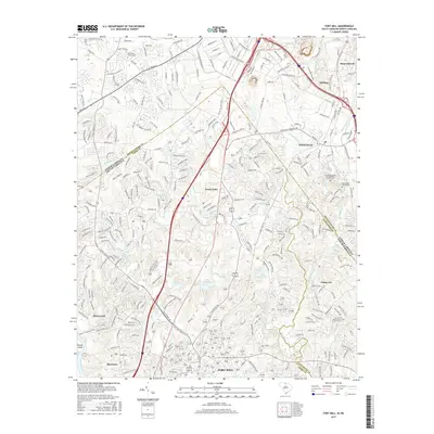
2017 Map of Fort Mill
USGS Topo · Published 2017About this map
Fort Mill and Pineville anchor this map at the border of North and South Carolina, showcasing the dense residential and industrial expansion between Charlotte and Rock Hill. The landscape is defined by its water features, including Forest Lake, Lake Patricia, and the Catawba River on the western edge. Historical and genealogical sites are scattered throughout, such as the Dinkins Cem and the McClintock Church Cem, providing a window into the region's long-established communities before modern suburban growth.
Find a feature on this map
42 named features on this map. Tap any name to fly to it.
Don’t see what you’re looking for? This feature index may not catch every label — zoom into the map to look around manually.
Map Details
Editions of this 2017 Fort Mill Map
This is the sole edition of this map. No revisions or reprints were ever made.
Other maps of this area

1905 · Charlotte
USGS Topo · 1:48,000

1907 · Charlotte
USGS Topo · 1:62,500

1941 · Charlotte
USGS Topo · 1:125,000

1941 · Spartanburg
USGS Topo · 1:250,000

1942 · Charlotte
USGS Topo · 1:125,000

1947 · Clover
USGS Topo · 1:62,500

1948 · Charlotte East
USGS Topo · 1:24,000

1948 · Charlotte West
USGS Topo · 1:24,000

1949 · Clover
USGS Topo · 1:62,500

1949 · Charlotte West
USGS Topo · 1:24,000