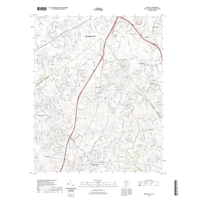
2020 Map of Fort Mill
USGS Topo · Published 2020About this map
The North Carolina and South Carolina border intersects a rapidly developing corridor between Charlotte and Fort Mill. The landscape is defined by the convergence of the Catawba River and its complex drainage network, including Steele Creek, Little Sugar Creek, and McAlpine Creek. Settlement patterns show the transition from traditional centers like Pineville to newer communities such as Tega Cay and Sharonbrook.
Find a feature on this map
333 named features on this map. Tap any name to fly to it.
Don’t see what you’re looking for? This feature index may not catch every label — zoom into the map to look around manually.
Map Details
Editions of this 2020 Fort Mill Map
This is the sole edition of this map. No revisions or reprints were ever made.
Other maps of this area

1905 · Charlotte
USGS Topo · 1:48,000

1907 · Charlotte
USGS Topo · 1:62,500

1941 · Charlotte
USGS Topo · 1:125,000

1941 · Spartanburg
USGS Topo · 1:250,000

1942 · Charlotte
USGS Topo · 1:125,000

1947 · Clover
USGS Topo · 1:62,500

1948 · Charlotte East
USGS Topo · 1:24,000

1948 · Charlotte West
USGS Topo · 1:24,000

1949 · Clover
USGS Topo · 1:62,500

1949 · Charlotte West
USGS Topo · 1:24,000