Loading...
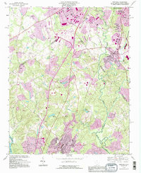
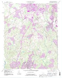
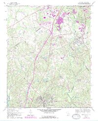
Loading map...1993 Map of Fort Mill
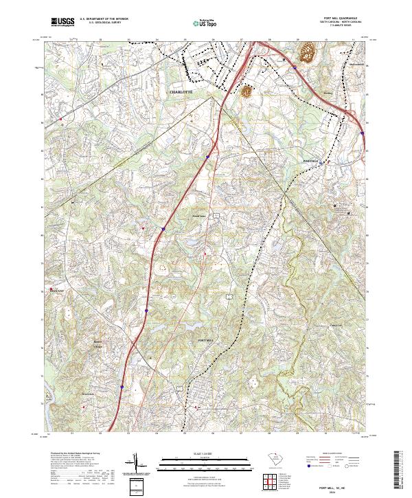
USGS Topo · Published 1996About this map
Sugar Creek and MC Alpine Creek dominate the drainage of this landscape as it straddles the Piedmont border between North Carolina and South Carolina. In the northern reaches, the Charlotte Corp BDY marks the rapid suburban expansion of the 1990s, where an Amusement Park complete with an Aerial Tramway stands as a regional landmark near Interchange 90. This era shows the transition of old family farmlands into developed corridors, though deep roots remain visible at the James K. Polk Birthplace near Pineville.
Find a feature on this map
63 named features on this map. Tap any name to fly to it.
Don’t see what you’re looking for? This feature index may not catch every label — zoom into the map to look around manually.
Map Details
Date Portrayed1993
Date Published1996
PublisherU.S. Geological Survey
Map TypeTopographic
Scale1:24000
Physical Dimensions21.9 x 26.8 inches
Editions of this 1993 Fort Mill Map
2 editions found
Historical Maps of Eden Gardens Through Time
4 maps found

Featured Locations
Source Details
SourceU.S. Geological Survey
CopyrightPublic Domain